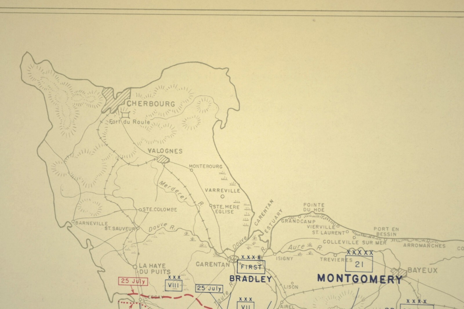
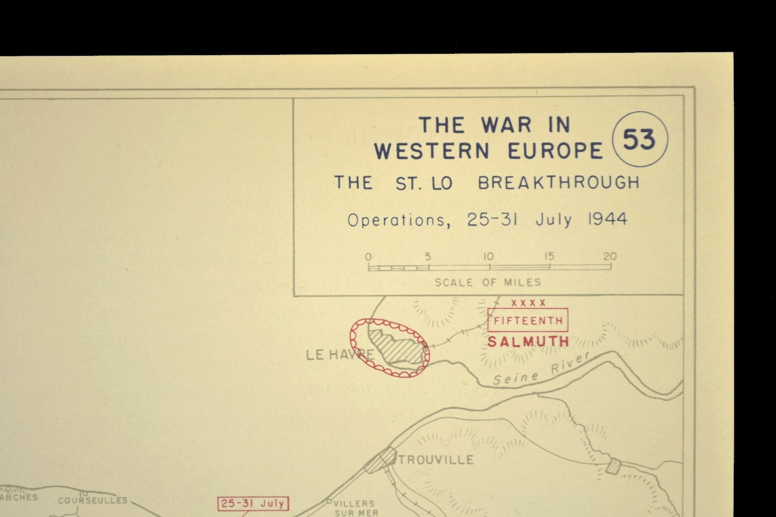
Vintage Normandy WWII Map Operation Cobra Breakthrough, Saint Lo
This vintage Normandy WWII map highlights Operation Cobra and the breakthrough of German lines near Saint Lo. It is in excellent condition with some browning from age, and it measures about 13" x 10". This item is listed in the Antiques category and may be suitable for collectors of World War II paper ephemera or historical map displays. Free shipping is included. Check the listing for details on any markings, print type, or additional historical notes.


| Location | Willow Grove US |
| Shipping | Free shipping (check listing for details) |
| Seller |
snapshotsthroughtime
100.0% positive · 1218 feedback
|
| Listing | FixedPrice · Active |
| Start time | 2026-03-12T15:04:07.000Z |
| Date Range | 1950-1959 |
| Format | Atlas Map |
| Original/Reproduction | Vintage Original |
Vintage Normandy Map Operation Cobra Breakthrough German Lines Saint Lo WWIIThis is an Original map taken from a 1950s West Point atlas titled The War in Western Europe - The St Lo Breakthrough which shows Operation Cobra and the WWII operations in Normandy France from July 25th to July 31st 1944. Included with this sale is a facsimile of the Basic (Battle Map) Symbols.This original atlas map is the perfect for framing and measures about 13" x 10". See photo showing a framed sample. **